Maps and Atlases Back to Collectables Back to Maps and Atlases
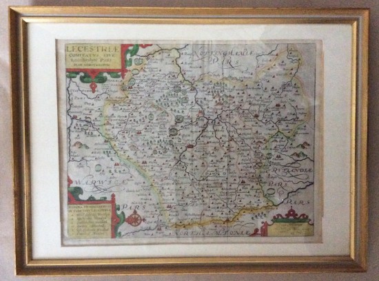
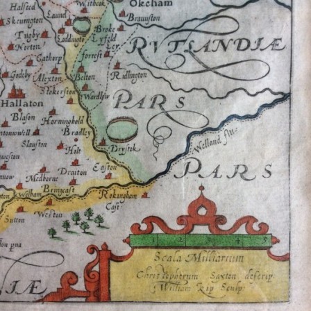
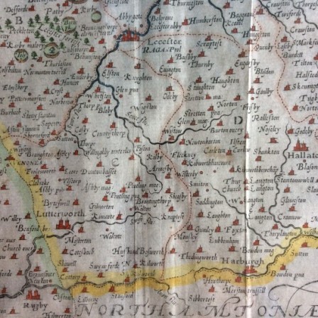
Antique hand coloured map of Leicestershire c1637
Country of Origin: England
Date: Early 17th century
Condition: Good original condition
Description: Hand coloured map of Leicestershire by Christopher Saxton/ William Kip. Framed. Colouring probably later. Map is from Camden’s Britannia 1607-1637.so has some folds . Is in undamaged condition with all margins visible under mount.
Dimensions: Framed 50.7cm x 38cm
Price: £175
Stock Number: AWC031302